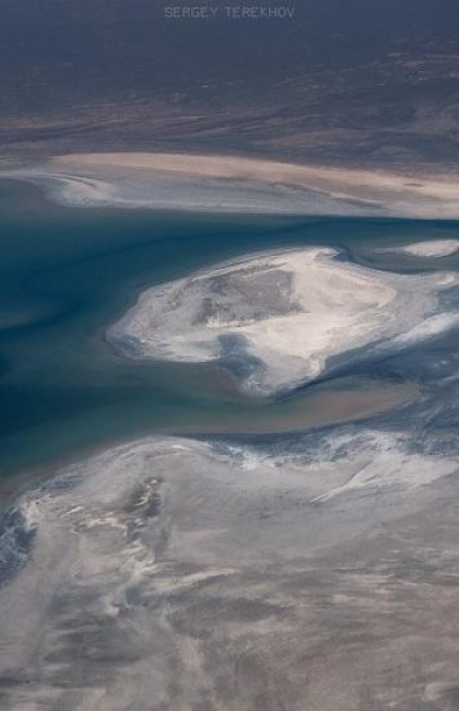
Kokaral Dam
In the late 1980s, the Aral Sea became so shallow that it split into two parts: the Northern and Southern Aral. The Syrdarya River flowed into the Northern Aral, with the narrow Berg Strait connecting the two sections. Scientists proposed that blocking the strait and preventing the Syrdarya's waters from flowing into the Southern Aral could raise the water level in the northern part. Attempts to build a sand and clay dam twice failed as both structures washed away, making it clear that a permanent concrete dam was necessary. The government of Kazakhstan sought help from the World Bank, which provided most of the funding for the construction.
The Kokaral Dam was completed in 2005. It was named after the nearby Kokaral Peninsula, which had turned into an ordinary piece of land by the early 21st century. The dam is 13 kilometers (8 mi) long and up to 150 meters (164 yd) wide, with a maximum water level of 42 meters (138 ft). When the water rises above this level, sluice gates open to discharge water into the Southern Aral. Unfortunately, this discharge carries fish into the highly saline Southern Aral, where they die. To prevent this, special acoustic installations were set up to scare fish away from the dam.
-large.jpeg)
As expected, the dam significantly increased the area of the Northern Aral. The reduced salinity of the water allowed fish to repopulate the sea, including species like bream and carp. This revitalization led to the restoration of fish processing plants, job creation, and a return of residents to the surrounding villages. The region's climate also improved: summers became cooler, and dust storms less frequent. The distance from Aralsk to the sea decreased from 100 kilometers (62 mi) to 25 kilometers (15.5 mi). The Kokaral Dam improved the region's life, correcting some of the past mistakes.
However, the Kokaral Dam also accelerated the drying of the Southern Aral Sea, as the Syrdarya's waters no longer reached it.
The height of the Kokaral Dam currently limits further increases in the Northern Aral's water level. Moreover, the dam is in poor condition. A reconstruction project has been discussed for several years, which would raise the dam's height by 6-8 meters (20-26 ft), but no concrete actions have been taken. If implemented, this project might even restore the former port of Aralsk to the seashore.
How to get there?
The Kokaral Dam is situated 30 kilometers (19 mi) northwest of the village of Karateren in the Kyzylorda region. It takes approximately three hours to reach the dam from the town of Aralsk, covering a distance of 196 kilometers (122 mi).
Other tourist attractions near the Kokaral Dam:
- Barsakelmes Nature Reserve
- Syrdarya River
- Mausoleum of Beketai
- Mausoleum of Basibek
- The Village of Akbasty

